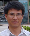
Dr. Yuming Wen
 |
Dr. Yuming Wen
Associate Professor of GIS
Phone: 671-735-2687 (fax 734-8890) (GMT+10 hrs)
ywen(weri)uguam.uog.edu?subject=Faculty - WeriGuam.org
|
Ph.D. Environmental Sciences (GIS & RS), University of Rhode Island
M.Eng. Surveying (GIS), Southwest Jiaotong University
B.Eng. Surveying, Shandong University of Science and Technology
Certified GIS Professional (GISP), GIS Certification Institute
ESRI Authorized Training Program (ATP) Instructor (2005-2010)
Research Interests
Dr. Wen’s main research interests include GIS, spatial analysis and modeling, geostatistical analysis, remote sensing, digital image processing and analysis, simulation of land-use and land-cover change, GPS, applications of geospatial technologies in solving water, environmental and coastal issues, and integration of geospatial technologies such as GIS, remote sensing and GPS. He leads the GIS Program at WERI, University of Guam (UOG). Dr. Wen has been involved in GIS and related projects including development of a GIS software system(All-Purpose Spatial Information Systems, APSIS) for China funded by China’s Ninth-Five-Year Plan, establishment of an integrated GIS-remote sensing geo-spatial and temporal database funded by China’s Natural Science Foundation, Spatial Diffusion Modeling for Simulation of Urban Land Cover Change, part of a National Aeronautics and Space Administration (NASA) funded project Multiple Innovative Models in Regional Land Cover Change Study, developing a digital watershed atlas for Guam funded by U.S. Geological Survey (USGS) through Water Institute Program and National Oceanic and Atmospheric Administration (NOAA) through Guam Bureau of Statistics and Plans, an FSM Atoll groundwater Resource Inventory project funded by USGS, Watershed Land Cover Change Detection in Guam funded by USGS, Land Cover Accuracy Assessment for Southern Guam funded by USGS,Impacts of Land Cover Change on Groundwater Quality in Guam funded by USGS, Applications of LiDAR Data for Inarajan Watershed Management funded by USGS, and Spatio-temporal Analysis of Groundwater Quality in Guam funded by Guam Hydrological Survey.
Dr. Wen is a member of Graduate Faculty in the Environmental Science program, and a member of Graduate Curricula Review Committee at UOG since 2005, members of the American Society for Photogrammetry & Remote Sensing (ASPRS), and International Society for Environmental Information Sciences (ISEIS). Dr. Wen teaches GIS courses at graduate and upper-division undergraduate levels, offers GIS training courses/workshops, and supervises graduate students in GIS related thesis research and projects.
Back to top ^


