Facilities
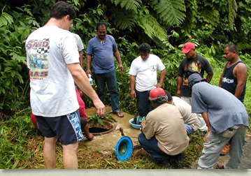
The water science building, which houses WERI, encompasses a total of approximately 6000 square feet. This includes faculty and staff office space, a 20-seat classroom, a 500 square foot GIS and engineer graphics laboratory and a 1300 square foot water quality analysis laboratory. The University provides all utilities plus a high-speed internet connection for all faculty and staff. The University of Guam computer center houses a site for a National Geodetic Survey continuously operating differential correcting Global Positioning System (GPS) site. This allows WERI researchers to easily correct positions taken in the field using GPS. The University of Guam computer center also serves as the host site for a National Oceanic and Atmospheric Administration (NOAA) GIS metadata server for the islands of the Western Pacific. This site allows WERI researchers and others access to the Metadata files for the multitude of GIS coverages available for the islands of the Western Pacific.
Water Quality Analysis Laboratory
The Water Quality Laboratory was started with the inception of the Water Resource Research Center in 1972. The laboratory's current staffing includes a Laboratory Manager and one full time Laboratory Technician. Part time research assistants are hired as required by analysis workloads.
The laboratory is equipped to perform a variety of Water Quality/Environmental Analysis in support of WERI research faculty, as well as support of the teaching faculty in the Environmental Science Program; Chemistry Department; the University of Guam Marine Laboratory; and the College of Natural and Applied Sciences. In addition the laboratory is available for student thesis projects.
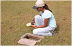
The laboratory also provides a variety of analytical services to public and private sectors of the community, and is USEPA certified to perform lead, copper and bacteriological analyses of drinking water. Various other physical and chemical tests are routinely carried out on aqueous samples and are available at commercially competitive rates. The laboratory also commonly conducts trace metal analysis on other environmental samples, particularly soils, sediments and biological materials.
For more information send e-mail to Ms. Jennifer Cruz : jencruz(weriguam)uguam.uog.edu?subject=Contact - WeriGuam.org
Back to top ^
GIS/Engineering Graphics Laboratory
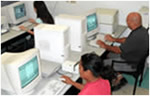
The Guam Hydrologic Survey GHS provides funding to support the operation of our state-of-the-art computer analysis and Geographic Information System (GIS)/Engineering Graphics laboratory. The GIS and engineer graphics laboratory includes office space for the GIS/Network administrator and a 6 station teaching laboratory. Equipment includes ten high speed workstations, one plan sized photo quality capable plotter and a plan sized digitizing tablet. The GIS laboratory provides the required hardware and expertise in GIS analysis and serves as a data archive for GIS generated databases.
University of Guam computer center houses a site for a National Geodetic Survey continuously operating differential correcting Global Positioning System (GPS) site. This allows WERI researchers using differential correction capable GPS equipment to easily correct positions taken in the field. The University of Guam computer center also serves as the host site for a National Oceanic and Atmospheric Administration (NOAA) GIS metadata server for the islands of the Western Pacific. This site allows WERI researchers and others access to the Metadata files for the multitude of GIS coverages available for the islands of the Western Pacific.
Back to top ^