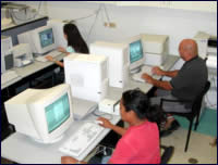
GIS LABORATORY
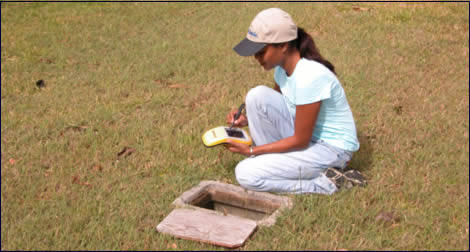
STUDENT RESEARCH ASSISTANT USING GPS EQUIPMENT
The Guam Hydrologic Survey GHS provides
funding to support the operation of our state
of the art computer analysis and Geographic Information
System (GIS)/Engineering Graphics laboratory.
The GIS and engineer graphics laboratory includes
office space for the GIS/Network administrator
and a 6 station teaching laboratory. Equipment
includes ten high speed workstations, one plan
sized photo quality capable plotter and a plan
sized digitizing tablet. The GIS laboratory
provides the required hardware and expertise
in GIS analysis and serves as a data archive
for GIS generated databases. STUDENTS
WORKING IN GIS LABORATORY
 The University of Guam computer center houses a
site for a National Geodetic Survey continuously
operating differential correcting Global Positioning
System (GPS) site. This allows WERI researchers
using differential correction capable GPS equipment
to easily correct positions taken in the field.
The University of Guam computer center also serves
as the host site for a National Oceanic and Atmospheric
Administration (NOAA) GIS metadata server for the
islands of the Western Pacific. This site allows
WERI researchers and others access to the Metadata
files for the multitude of GIS coverages available
for the islands of the Western Pacific. The University of Guam computer center houses a
site for a National Geodetic Survey continuously
operating differential correcting Global Positioning
System (GPS) site. This allows WERI researchers
using differential correction capable GPS equipment
to easily correct positions taken in the field.
The University of Guam computer center also serves
as the host site for a National Oceanic and Atmospheric
Administration (NOAA) GIS metadata server for the
islands of the Western Pacific. This site allows
WERI researchers and others access to the Metadata
files for the multitude of GIS coverages available
for the islands of the Western Pacific.
|