Water Resources Management and GIS
Geospatial technologies such as geographical information systems (GIS) and remote sensing can be applied to solve water resources and environmental issues effectively. GIS and related technologies are an efficient tool for watershed management, water distribution, environmental modeling and analysis, modeling and analysis of water quality and quantity, land cover change detection, natural resources management, climate change, hydrological modeling, soil erosion modeling, applications of LiDAR and hyperspectral/high resolution satellite data, etc.
For further information on the GIS projects currently underway, please contact Dr. Yuming Wen at ywen(weri)uguam.uog.edu?subject=GIS Program - WeriGuam.org or +1 671 735-2687
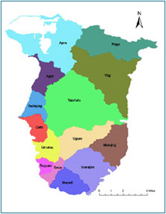
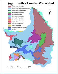
Digital Watershed Atlas
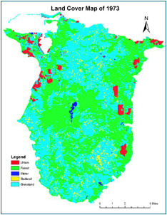
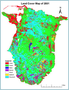
Land Cover Change Detection
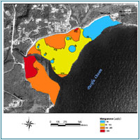
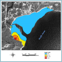
Environmental Modeling
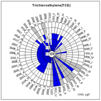
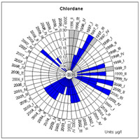
Spatio-temporal Analysis of Water Quality Data
Note: White sectors stand for no samples collected for the well, gray for non-detectable values, and blue for actual values analyzed from samples. Left: Well D-5, and right: Well D-15.
Back to top ^