Other Sponsored Research
NOAA
Natural Resources of Southern Guam
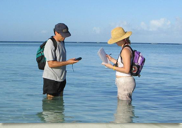
A common problem in Guam, as well as every other place in the Western Pacific is the lack of accessibility to local natural resources data. This includes vegetation, soil types, river miles, badlands, roads, location of stream gage, and maps. In Guam, this information is scattered among government agencies.
In 2005, WERI researchers, Drs. Shahram Khosrowpanah and Yuming Wen, and their collaborator, Dr. Danko Taborosi of Island Research & Education Initiative, Pohnpei, began constructing a digital atlas of the natural resources of southern Guam’s watersheds using GIS technology to centralize these scattered data sets. The project was partially funded by the National Oceanic and Atmospheric Administration (NOAA) through the Guam Bureau of Statistics and Plans Office.
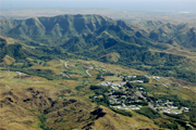
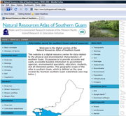
The finished product, aptly named the ‘Natural Resources Atlas of Southern Guam’ was designed as a reference and educational tool that provides a comprehensive picture of the natural resources found within the fourteen watersheds of southern Guam. It was designed as a comprehensive and user-friendly web-based information server and is freely accessible on the Internet at http://www.hydroguam.net.
The website offers a wide range of textual, graphical, statistical, and geographic information to any interested user, and allows advanced operations, such as viewing and manipulation of GIS data using standard web browsing software. It is the foundation of a planned series of products dedicated to disseminating information and raising public awareness of the diversity, current state, sustainable use, and critical threats to natural features of southern Guam, and is being widely used by Guam’s agencies, researchers, developers, students, and the community at large. For further information about the website or the natural resources of southern Guam watersheds, contact D. Shahram Khosrowpanah at khosrow(weriguam)uguam.uog.edu?subject=Contact - WeriGuam.org
Back to top ^