Other Sponsored Research
USEPA
GWUDI Study
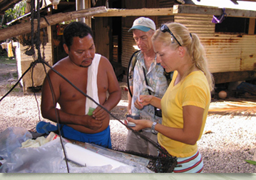
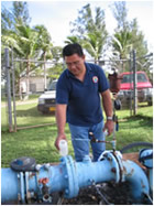
WERI is currently engaged in an ongoing collaborative study with representatives from the United States Environmental Protection Agency (USEPA), Guam Environmental Protection Agency, (GEPA), Guam Waterworks Authority (GWA), the military and the private sector; to determine whether Guam’s aquifer should be designated as groundwater under the direct influence (GWUDI) of surface water and, as such, fall under the USEPA Surface Water Treatment Rule (SWTR) of 1989 and subsequent amendments.
Background
The SWTR requires all raw water sources be evaluated to determine if they are surface water or groundwater. The definition of surface water includes groundwater under the direct influence (GWUDI) of surface water (i.e., groundwater in aquifers that rapidly recharge). The purpose of the rule is to remove waterborne, disease-causing microbes from drinking water, specifically the viruses, Legionella (a bacterium), Giardia and Cryptosporidium (microscopic parasites). These organisms, while not normally found in groundwater, may occur under GWUDI conditions.
The aquifer encompassing the northern half of Guam consists primarily of uplifted fractured limestone. Such aquifers are highly porous and recharge rapidly during storm events. They are also generally regarded as sensitive to surface water contamination and there are many sources of such contamination in northern Guam. Raw sewage overflows from inadequate wastewater facilities, particularly during wet weather conditions, can run directly into recharge basins, as can urban runoff and animal wastes from the many small-scale animal husbandry operations that currently exist. In fact, there is a long history of microbial contamination in Guam’s groundwater. As a result, mandatory chlorination is currently required for all the islands drinking water production wells.
It has been suggested that the entire aquifer be designated as groundwater under the direct influence of surface water (GWUDI), because of this contamination, and because groundwater contamination can rapidly follow major rain events. However, current USEPA guidance for the determination of GWUDI does not adequately address this hydrogeological setting. This guidance was developed primarily for aquifers in unconsolidated soils and for water flowing from surface water bodies such as lakes and rivers. The purpose was to identify situations where inadequate barriers, natural filtration, or time for pathogen inactivation existed between these surface waters and the groundwater reaching a well. In these cases, additional treatment in the form of filtration and enhanced disinfection might be required. The guidance was not designed for rainfall-induced transport of contaminants, nor for deep aquifers.
In addition, specific data normally used for this determination are limited or lacking. These include water quality information to quantitatively demonstrate relatedness, and microscopic particulate analysis results that can indicate the presence of materials not normally associated with true groundwater. Additionally, while some wells show frequent and/or persistent contamination, many have no history of contamination. The depth to groundwater is generally large (300' is common), allowing for some physical and temporal barriers in some cases. This means that, while concern for direct influence is warranted, whether all or the majority of the ~150 public water supply wells should be so designated is unclear. Because of these reasons, classification of the wells and/or aquifer remains controversial.
The ongoing study was designed to provide the necessary information to make the GWUDI determination and to help select appropriate water treatment. It essentially involves correlating measurable changes in aquifer turbidity, temperature, conductivity, hardness, microscopic particle characteristics, and coliform bacteria detections with significant storm events. To this end, automated water quality monitoring devices and data loggers have been fitted to 25 drinking water production wells selected in high and low-risk areas. Rainfall data is also being recorded from a network of rain gauges set up across the northern half of the island. WERI’s primary roles in the study are to gather the precipitation data, coordinate the sampling activities of all other collaborative entities, and evaluate and statistically examine the overall data. Further details are available from WERI Meteorologist, Dr. Mark Lander, at mlander(weriguam)uguam.uog.edu?subject=Contact - WeriGuam.org.
Back to top ^